f360Vision.
Work with your data sets.
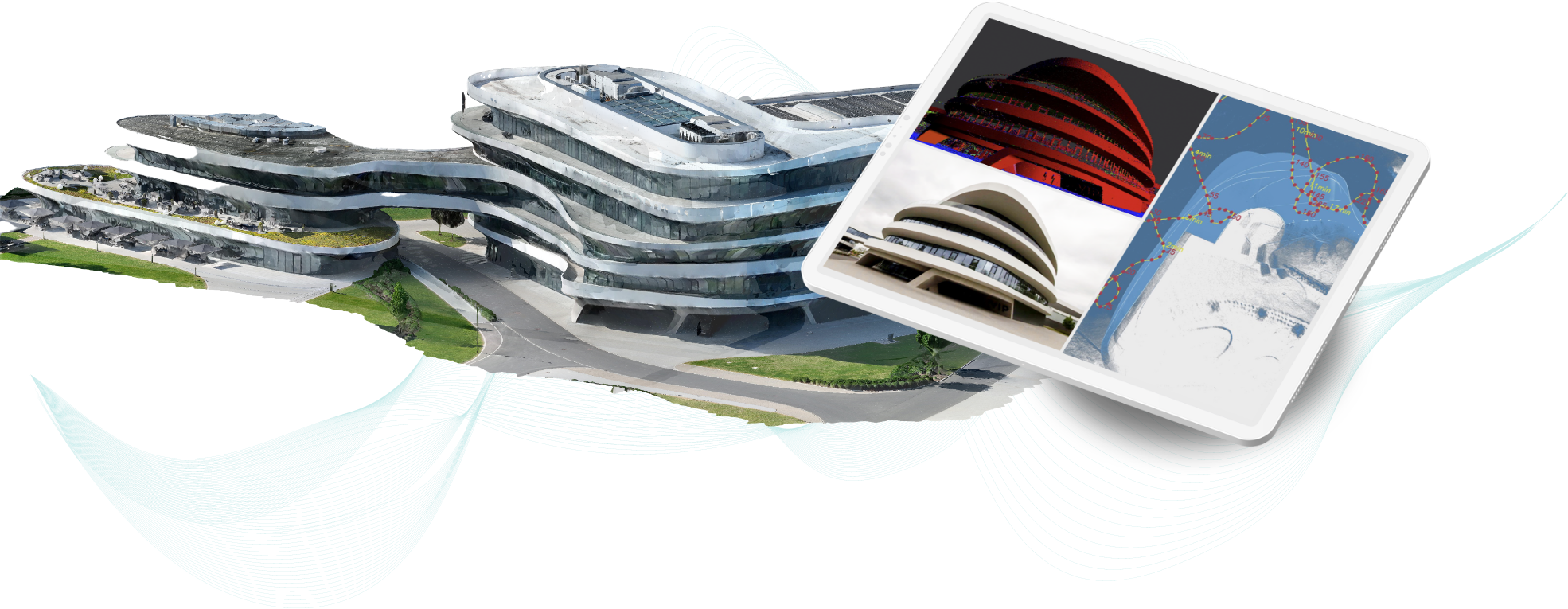
Have you had your factory, school, residential building or any other type of property scanned using 3D laser scanning and now have a huge data set that you don’t know how to use?
Are you currently using your data with a hosting provider but want to become independent of subscription models?
Is your data currently in the cloud and you want to host it on your own server?
Do you want to save on the cost of viewer software?
If you answered yes to any of these questions, you’ve come to the right place.
About f360Vision
Our viewer is working on different devices
- Desktop Windows
- macOS
- On-premise company server via docker image
- Cloud server via docker image

Advantages of our f360Vision
- viewer completly free
- No subscription
- Data stays with the customer
- High performance
- Usable online & offline
- No user limits
- Simple navigation
- Easy measuring tools
You‘ll only pay once for a dataset
- Only pay for preparing your dataset (e57) for viewer
- No hidden fees – viewer completly free
- No monthly costs – no subscription
- No Additional user costs – copy as you like

FAQ
Here are some of the most important questions and answers to clarify as much as possible in advance.
Is the software really free?
Yes. There are no subscription fees and no costs for additional users.
Which file formats are supported?
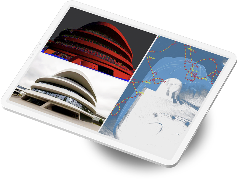
Large point clouds (max. 4 billion points, E57 with or without 360° panoramas).
Does the viewer work without internet?
Yes. The desktop app works fully offline. Server deployments can also run without external connections.
How are measurements performed?
Directly in the viewer: coordinates, distances, areas, heights.
What about data privacy?
Your data stays with you – on-premise or in your own cloud. No prepared project files are transferred to third parties.
Download our f360Vision
Download for: Desktop Windows, Desktop macOS, Docker image